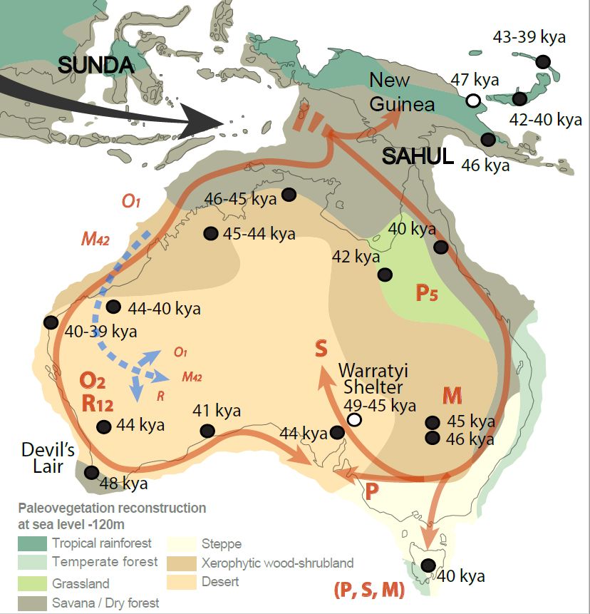
The Peopling of Australia. Model of the peopling of Australia combining genetic and archeological data, showing approximate, and stylised, coastal movements of haplogroups O and R (West) and P, S, and M (East). The inferred movement of S into the interior is influenced by the path of a recent study on water sources and human movement. Data from other studies where pre-European distributions are unclear are indicated with a dagger (†), and include a potential late-glacial movement into the Western Central Desert region (blue dashed arrows, see methods). Early Archeological sites in Australia and New Guinea (black dots) are given with mean ages for earliest occupation of sites in each region (supplementary table 4). Insufficient data were available for sites with white dots, which were not used in the age model for the initial Sahul colonization date but provide independent age controls. Ages in Southwestern and South Central Australi, at Devil's Lair (49–46 KA) and Warratyi Rock Shelter (49–45 KA), suggest that the overall population movements were rapid and that the coastal regions of Australia were colonized within a few thousands years. Approximate late Pleistocene vegegation reconstructions are shown.